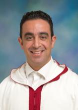
Adnane Labbaci studied forestry at the National School of Forestry Engineers and holds a PhD in GIS and remote sensing from the Université Ibn Zohr d’Agadir of Morocco. After earning his diploma, he worked for ten years in the High Commission of Water Forests and Combating Desertification of Morocco, implementing government decisions on forests and watershed management, desertification mitigation and climate change adaptation. In addition, Mr. Labbaci developed a regional geospatial database to establish baselines for forest ecosystems assessment and methodology to combat desertification. Prior to attending the Humphrey program, he was a chief of the GIS and Remote Sensing Bureau, Desertification Bureau and Partnership Office.
His professional interests are in research for sustainable development of natural resources especially forest ecosystems, combating desertification, partnership and climate change adaptation and mitigation.
During his fellowship year with the Humphrey Program, Mr. Labbaci wants to learn more about monitoring climate change effects on natural resources and geospatial processes to improve the sustainability of forests, in order to sequestrate carbon and mitigate climate change effects in the southern and western regions of Morocco. Specifically, he wants to gain more technical experience in web mapping, climate change modeling and developing partnerships with international organizations.
Last updated: 2016