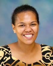
Ms. Litia Gaunavou-Tuberi has been a remote sensing officer at the Pacific Community-Geoscience Division since 2009. She specializes in image data purchase and the pre-processing of high resolution satellite data for the South Pacific region. Her work with pre-processing satellite data gained recognition from the DigitaGlobe Incorporation in 2012 when the Pacific Community was presented with an Innovation Award.
For the last five years, her work has revolved around more specific projects which research food security adaptation strategies and forest monitoring through the use of geospatial and remote sensing tools. Her work in this area has motivated her to study for a Masters in Environmental Science from the University of the South Pacific.
Her professional interests are in researching sustainable natural resource development and more specifically the automatic separation of various tree species from satellite image data with the use of cloud-based computing and other methodologies. This will assist Pacific island countries in fortifying the climate change strategies that are already in place.
During her fellowship year with the Humphrey Program, Ms. Tuberi would like to advance her knowledge in remote sensing applications. She hopes to improve her technical skills so she can better assist countries in the South Pacific region to map and have sustainable strategies for the management of their natural resources.
Last updated: 2017